|
When
you open FX-Net and click on Each sub-menu is filled with datasets, too many to list seperately here. The most popular products are most likely the products from SPC, namely the convective outlooks, threat charts, and fire weather forecasts. From HPC, there are many precipitation products, both analyses and forecasts, as well as weather depiction and front positions and forecasts. Also included with HPC products are several NGM MOS forecast datasets. The MPC menu item, Marine Guidance, opens a menu with many analysis and forecast products, including, but not limited to, surface pressure, fronts and winds, upper-air streamlines, and wave height conditions and forecasts. Below, a few interesting products will be displayed from each section of the NCEP/Hydro menu. |
 |
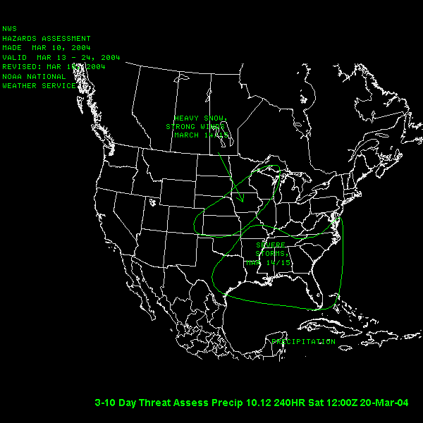 |
Choosing Threat Charts from the NCEP/Hydro menu opens a cascading menu with many choices, including a 3-10 day precipitation threat assesment, shown to the left, and short and long-term heat index threat assesments. The image to the left shows a forecast of heavy snow and strong winds in the midwest and plains states, and severe storms in the southeast US. The forecast is made and is valid for 3-10 days from the forecast date. |
|
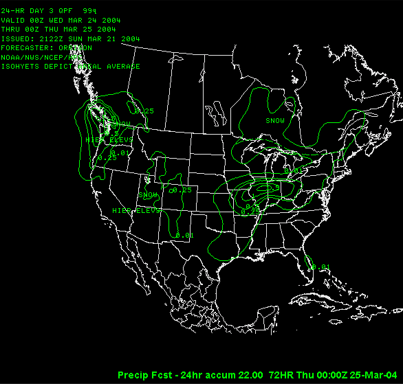
The **HPC** section of the NCEP/Hydro menu offers many precipitation, temperature and weather products, of both analysis and forecast type. Long term temperature and precipitation anomaly products are also available. To the right is a product that shows 24-hour precipitation accumulation. Areas of snow are noted, and precipitation totals are contoured. This product is a 3-day forecast, and was loaded by choosing Precip Accum - 24 hr from the Precip & Stablilty in the NCEP/Hydro menu. |
 |
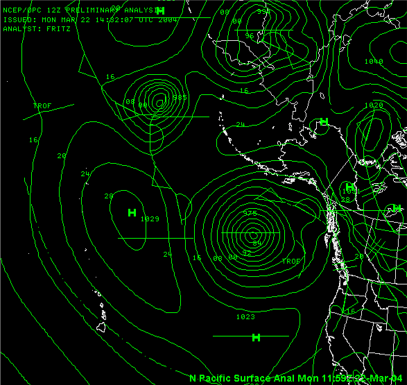 |
The **MPC** section of the NCEP/Hydro menu has Marine Guidance for the West Atlantic, North Atlantic, East Pacific and North Pacific. Surface analyses, front position, upper-air winds, and even wave information is available for these areas. The image to the left displays a surface analysis for the North Pacific region. This was loaded into FX-Net by selecting a North Hemisphere view in the primary window, then choosing Surface Analysis from the Marine Guidance section of the NCEP/Hydro menu. |